
Trace a Fort Collins Street by Address
A Fort Collins by-address search works best as an address chain. Begin with a street number and name, then preserve every identifier that turns the label into a record: parcel, account, legal description, reception number, and source date. The county Assessor and GIS viewer establish the property key. Landmark Web supplies recorded parties. Historical Street Guide entries, newspapers, and voter rules add dated context without pretending that one source names everyone at an address.
- Enter the street number and name in the Larimer Assessor, using the city, ZIP, subdivision, or a number range to narrow the result.
- Save the parcel, account, owner, situs address, legal description, and map link from the property result.
- Open Larimer GIS and city FCMaps to inspect parcels, address points, lots, blocks, annexations, and city limits along the segment.
- Translate the address into a legal description or party name, then search the recorder's deed index and follow the current grantor backward.
- Add a voter-file request, historical Street Guide, telephone book, newspaper, or census clue only for the date and purpose that source covers.
That order keeps a street label in proportion and gives a failed search a clear fallback: counter, request form, library, or archive.
Search Fort Collins Streets in the Assessor
The Larimer Assessor search accepts a specific parcel or account route and a general address route. For a Fort Collins street, an address-number range, street name, city, subdivision, or ZIP can narrow the first 500-result ceiling. The field instructions say to omit directional prefixes and street suffixes, and to use County Road instead of CR.
Save the parcel and account before opening a map or deed. Owner names can belong to a person, co-owner, entity, trust, or estate, so punctuation and spelling variants matter. Public result columns include account, parcel, owner, occupancy description, address, city, ZIP, tax district, and actual value.
The inspected property form exposes these real search controls:
| Field | Type | Required | Format or street use |
|---|---|---|---|
| Parcel Number | Text | Specific route | Ten digits or 12345-06-890 |
| Owner Name | Text | Optional | Last, First, with entity variants when needed |
| Address Number From/To | Number pair | Optional | Use a range to walk one street segment |
| Street Name | Text | Optional | Omit direction and suffix; use County Road instead of CR |
| City | Dropdown | Optional | Select FORT COLLINS or another named Larimer community |
| Subdivision Name or ZIP Code | Typeahead or dropdown | Optional | Subdivision names need three letters; ZIP has a map option |
| Sold in the last | Dropdown | Optional | Any date, or one through five years |
Free search is online. The Assessor also offers public-data downloads, in-person help at 200 West Oak Street, second floor, phone at 970-498-7050, and email at LCassessor@co.larimer.co.us.
Read a Fort Collins Parcel Card
A parcel result is the handoff point between an address and the Fort Collins address record trail. The card can expose account, parcel, owner, occupancy description, situs, ZIP, tax area, value, building, tax history, map, and comparable sales. Save the legal or subdivision text because the recorder does not treat a street label as its strongest key.
The public sample exposed General Info, Building Info, Tax History, Property Map, and Comparables tabs, with protected fields omitted. A tax card is a property record, not a complete list of people at an address.
The inspected Assessor property response shows the bridge from a street label to a mapped property. The office page remains the procedure fallback.
The captured result shows why an account or parcel is worth saving before the search moves to deeds, permits, or adjacent parcels.
Walk Fort Collins Parcels in GIS
The Larimer Land Information GIS viewer lets a researcher walk a Fort Collins street by map click. Use Identify on the target parcel, then pan to parcels sharing a boundary or lying across the road. Turn on addresses, parcels, subdivisions, platted lots and blocks, recorded dimensions, sales, tax districts, flood context, and neighborhood or association layers as needed.
The current City FCMaps experience supplies a second stack for parcel addresses, annexations, neighborhoods, city limits, precincts, council districts, zoning, and permits. County GIS explains land-record geography; city layers explain municipal context. Neither map is a resident roster.
Identify, print, export, share, bookmark, and previous-extent tools help preserve the map step. Keep each parcel number. An adjacent polygon can be a right of way, alley, open space, or separate unit.
The parcel viewer capture shows the layer-based street method.
Use the map for geography, then use the parcel identifier to reach the custodian.
Fort Collins Records Along a Street
Address-keyed records answer different parts of the Fort Collins street-record question. The Assessor is strongest for parcel and recorded-owner fields. GIS is strongest for location. Deeds and liens show recorded parties and legal descriptions. City permit maps show work at an address. Voter data can show permitted residential fields through a formal route, while historical directories show dated occupants or subscribers.
| Record Set | Keeper | What It Shows | Access |
|---|---|---|---|
| Assessor property card | Larimer Assessor | Parcel, owner, situs, value, map, and tax fields | Free search; 500-result cap |
| GIS parcel layers | Larimer GIS and FCMaps | Boundaries, addresses, lots, blocks, limits, and districts | Public map tools |
| Deeds and liens | Larimer Clerk and Recorder | Grantor, grantee, legal description, date, and reception | Online index; counter and copy routes |
| Voter data | Colorado SOS and Larimer Elections | Permitted public name, residence, status, and party fields | Formal request; self-check is not street-wide |
| Permits and site plans | Fort Collins records staff | Current, expired, or all permit map context | Map plus CORA request for documents |
Join the sets with parcel and legal description, not a name alone. A street number finds a site, the parcel finds the county record, legal text finds the deed, and a dated directory or voter source supplies a separate presence clue.
Turn a Fort Collins Address Into Legal Text
A street number is an access label, not the language a deed prefers. After the Assessor returns a parcel, account, subdivision, lot, block, or short legal description, carry those fields into the county GIS viewer and Landmark Web. The Assessor Sales file can add reception number, grantor, grantee, sale date, price, deed code, and description.
The rendered Assessor form below shows the field layout that starts this translation. It is useful for a number range or street segment, but it should be narrowed by city, subdivision, ZIP, or parcel before the result cap hides part of the search.
Open the inspected Fort Collins Assessor field screen to compare the live controls with the search terms saved from the address.
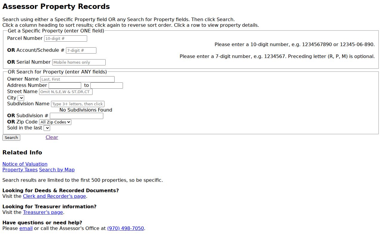
The form capture reinforces the need to save the parcel and account before crossing from address search into legal-description research.
- Parcel
- A mapped property unit tied to an account and legal description.
- Situs address
- The physical taxable location, separate from an owner's mailing address.
- Plat
- A recorded map that helps connect lots, blocks, subdivision lines, and dimensions.
- Criss-cross directory
- A reverse address-to-name tool. Fort Collins' Street Guide fills that role, though a separately titled local series was not located.
Fort Collins Deeds Along the Street
Landmark Web is the recorder's address-search bridge. The online index covers documents recorded from 1971 to present, while older grantor-grantee books remain at 200 West Oak Street. Search by party name, legal text, reception number, book and page, document type, or date. A street address can start the trail, but the legal description and recorded party usually carry it forward.
For a current parcel, find the present grantee, read the legal description, then search the seller as an earlier grantee. Save the document type, reception number, date, pages, linked documents, and image status. The index is free. Watermarked images need an account, and unwatermarked downloads require payment.
The Landmark Web capture shows the grantor, grantee, document, and image-access route used for a Fort Collins deed search.
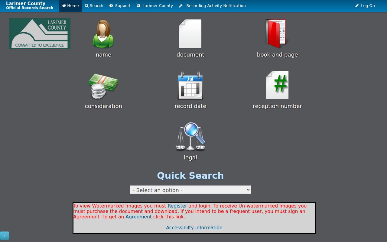
Anonymous users can search data only. The Recording Department also offers public terminals, mail or phone certified-copy requests, and counter copies. Regular copies are listed at $0.25 per page, certification adds $1 per document, and maps are $2 per page. A deed shows a recorded transfer, not a complete list of people at the property.
Fort Collins Permits and CORA by Address
City permit maps add a work-history layer to Fort Collins address research. FCMaps services identify current, expired, and all building permits, along with address-number, building, and unit layers. A permit can date an alteration or point to a file, but a map symbol does not by itself show every owner or person connected with the site.
When a site plan, permit sheet, or code document is not downloadable, use the Fort Collins public-records route. Requests can go through the city portal, in person, by email at CORA@fortcollins.gov, or by phone at 970-221-6515. Include the street address, parcel, permit type, department, and date range. Exact property lines remain a private-survey question.
Code-compliance material needs the same care. No dedicated public name-and-address case portal was verified. A narrow request to the city custodian can locate a record, but a complaint or code file should be described as that record and not recast as a finding about a person.
The Assessor application endpoint was inspected during the address workflow:
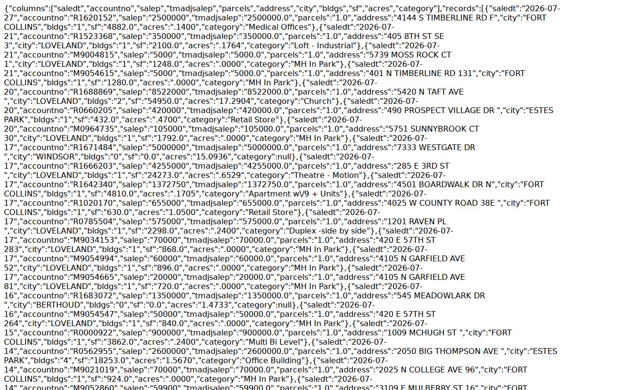
The endpoint capture is a technical handoff for the property search, not a new public roster. Keep the parcel key and route any missing document to the custodian.
Old Fort Collins Street Guides and Occupants
History Connection's city directories are the local historical street tool. Annual volumes have alphabetical people and business names, a Street Guide with addresses and occupants, a business-by-type section, and a rural section. A separate branded criss-cross series was not located, but the Street Guide provides the practical address-to-name reversal.
Runs begin with the verified 1902 volume and continue unevenly through later decades. The 1941 to 1947 gap is partly addressed by telephone books, newspapers, and census material. Record the period spelling, house number, occupation, spouse or widow notation, and city or rural designation before comparing years.
Online scans, print, microfilm, library help, and archive requests all matter. The complete collection, including the 1902 Kelley and Carroll item, is covered on the Fort Collins city directory page. A historic directory line is a dated clue, not a current street roster.
Fort Collins Street Names Through Time
Street continuity is not automatic. Fort Collins history materials say the lettered streets of Tres Colonias were renamed in 1975 and 1976. Larimer County adopted road-naming regulations in 2006 and a new Road Naming and Site Addressing Resolution in September 2025. The current project addresses duplicate or similar names, unnamed private drives, parity, and nonsequential numbers.
County Addressing covers unincorporated Larimer, while Fort Collins maintains municipal address and map resources. The county contact route is Road Name and Address Changes, with 970-498-5022 and Larimeraddressing@larimer.gov. An address request uses owner or agent contact, parcel or legal description, property sketch, property lines, and driveway intersection.
Bridge an older name with directories, historic maps, deed legal text, parcel layers, annexation records, and preservation staff. A new site address changes the search key, not the historic wording inside a deed or directory.
Fort Collins Mailing and Situs Addresses
Assessor Account and Owner Location files split the owner's mailing address from the property's situs address. Mailing fields show where tax correspondence goes. Situs fields identify the physical parcel. The two can point to different cities or states, or the mailing entry can belong to an entity, trust, estate, or representative.
That distinction matters whenever a Fort Collins address result moves from property to person. Use a mailing address as a tax-correspondence clue, not a residence claim. Use the parcel, legal description, and date to join the Assessor to a deed. Use a separate dated voter, directory, or newspaper record for presence.
The Larimer Assessor office source describes the public-data and property-search route. Its capture below is a reminder that the property roll and the physical street key are related but not identical.
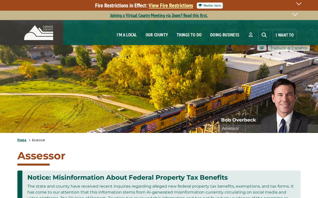
Keep the situs and mailing fields in separate notes. Merging them can turn an owner correspondence location into an unsupported statement about where a person lives.
Limits of a Fort Collins Street Directory
A Fort Collins address search can connect a site to a parcel, recorded owner, permit, voter-file field, or dated historical entry. It cannot promise a complete list of people at the site. Household members, visitors, utility customers, and DMV address data are outside the public street chain. An owner mailing address can be elsewhere, and a protected voter or sealed record can be intentionally absent.
Use each record only for the fact it holds. A map is geography, a deed is a transfer, a permit is work history, and a directory is a dated publication.
Lawful personal use. Fort Collins address records support family history, civic review, property history, and correction of one's own record. Public availability is not permission to stalk, harass, threaten, or intimidate anyone.
When the goal shifts from a whole street to one person, compare two independent anchors and request only the permitted record. A street number is a beginning, not a verdict.